
Planning for Agriculture in Virginia
- Why and How
- Farmland Protection
- Agricultural Viability
- Conservation Agriculture
- Additional Resources
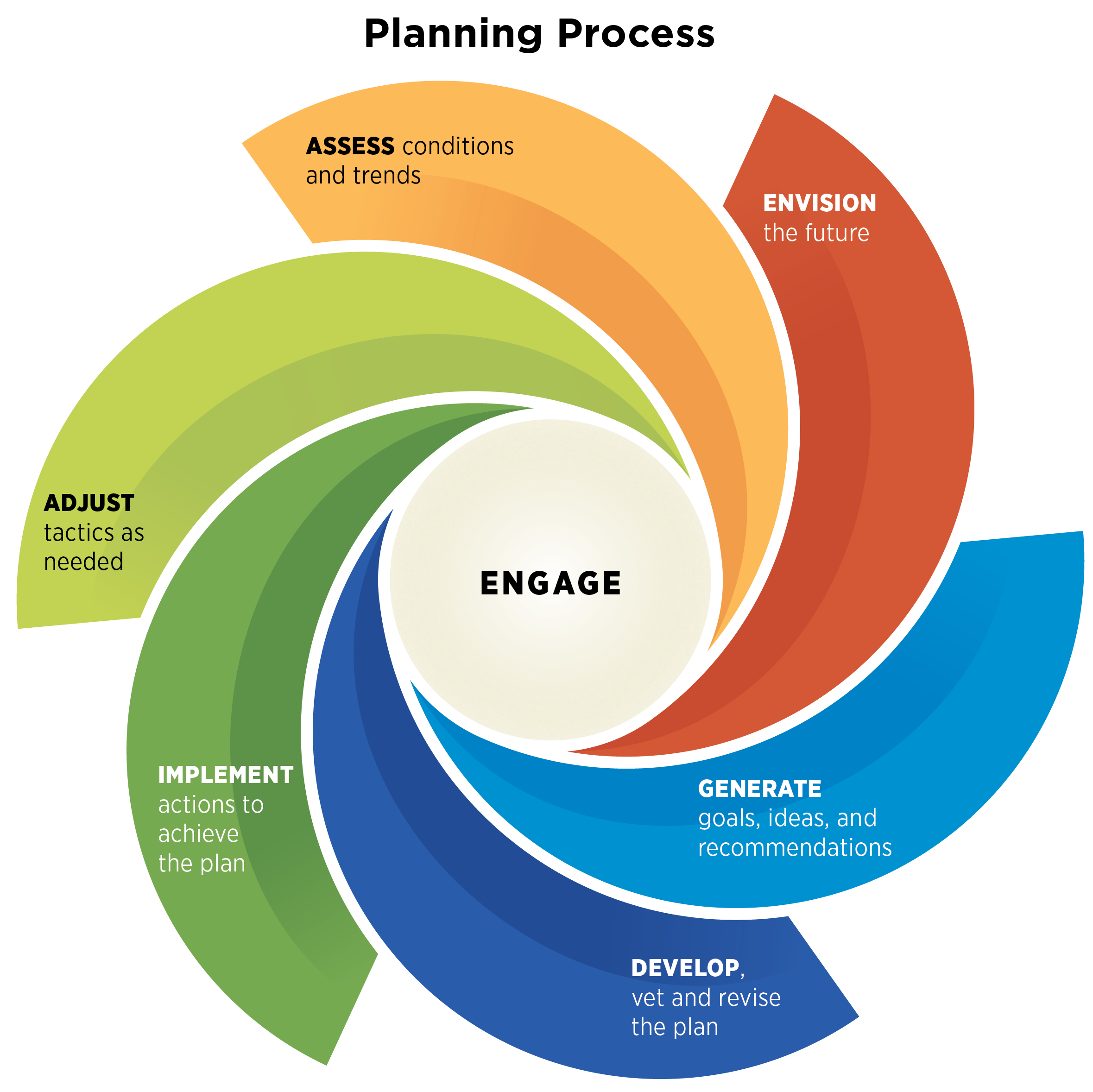
The “Why” and “How” of Planning for Agriculture
Why Should a Community Plan for Agriculture?
Agriculture is Virginia’s number one private industry, but it faces many challenges. Census of Agriculture data shows that the number of Virginia farms declined by 18 percent between 2012-2022—a loss of more than 7,000 small and midsized farms in only ten years. New farmers struggle to afford and access land, and aging farmers have challenges with succession planning. Profit margins are slim, and volatile weather patterns make production more difficult. Poorly planned growth and development are projected to convert 600,000–800,000 acres of farmland in the next two decades.
Despite these challenges, communities can take action to cultivate a sustainable and resilient future for agriculture, one that holistically values all that farming offers to the Commonwealth. Planning for agriculture offers a hopeful path forward, one rooted in thoughtful and intentional strategies. This process empowers communities to take their future into their own hands to advance a shared vision for agricultural land use, stewardship, and economic development. With this approach, local farms and the communities that support them can flourish.


How Can a Community Plan for Agriculture in Virginia?
In Virginia, local governments control land use and other planning-related decisions in their jurisdictions. This includes planning for agriculture, whether as a stand-alone plan or as a component of a comprehensive, economic development, or other local plan.
Planning for agriculture is an iterative process to engage farmers, local leaders, planners, and concerned community members in developing a shared vision and goals. Guided by public input and grounded in research, the process results in a game plan that can be adjusted and changed over time. Plans for agriculture are not static documents that gather dust on shelves. Instead, they are strategic, implementable plans that help communities create the conditions for agriculture to thrive.
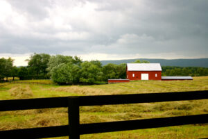
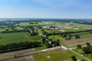
Farmland Protection and Thoughtful Growth
Virginia’s farmland is under threat. Between 2001 and 2016, 340,000 acres of Virginia’s farmland were converted to development—enough land to generate $164 million in annual agricultural revenue. Nearly a third of this land was “Nationally Significant,” meaning it was particularly well-suited for agricultural production. Most of the farmland loss came from sporadic, low-density residential development. While not always immediately visible, extensive low-density development can lead to suburbanization over time, making agriculture less viable. Building on this work, AFT has now projected that 50 counties (or county-equivalents) could lose more than 10 percent of their farmland by 2040—with 18 counties projected to lose more than 10,000 acres each.
By protecting farmland and pursuing thoughtful growth, communities can retain productive acreage while accommodating other public needs, like affordable housing, efficient transportation, and renewable energy. The series of strategies and policies below offer various measures that local leaders can take to ensure a future for the foundation of agriculture: the land itself.
Comprehensive Land Use Planning in Virginia
The Virginia legislature has delegated control over land use decisions to local governments, including the authority for land use planning and zoning. State law calls for local planning commissions to prepare and recommend Comprehensive Plans to guide the physical development of territory in their jurisdictions. As such, decisions and plans vary widely between communities. Local governments must adopt Comprehensive Plans, review them, and potentially update them every five years.
Agricultural and Forestal Districts
Agricultural and Forestal Districts are voluntary rural conservation areas reserved for farm and forest production. They promote the retention of working lands as an important economic and environmental resource. In exchange for enrollment, landowners receive use-value assessment and protections from eminent domain.
Cost of Community Services Studies
Cost of Community Services studies compare revenues from major land uses with expenditures to provide them with public services. In Virginia as elsewhere, they find that residential development has a negative revenue-expense ratio, demanding more in services like schools and public safety than they contribute in revenue. On the other hand, agricultural and forestal lands – like other commercial land uses – contribute more to local coffers than they receive back in services.
Purchase of Development Rights
Purchase of Development Rights (PDR) programs protect farmland for farming forever. They achieve this by paying landowners to voluntarily restrict development on their properties and then protecting the land with an agricultural conservation easement—a voluntary and flexible legal agreement.
Renewable Energy and Solar Development
In recent years, the renewable energy industry—and especially solar—has expanded greatly in Virginia. That growth appears poised to continue. Communities can take steps to ensure that any expansion of renewable energy facilities, such as solar arrays, occurs in a way that values and protects farmland while also supporting clean energy and economic opportunity.
Transfer of Development Rights
Transfer of development rights (TDR) programs are a growth management tool that combines planning and zoning to address community priorities. They create market incentives to shift development from designated “sending areas” – like areas designated for farmland protection – to “receiving areas” where increased development is preferred. They do this by compensating landowners who sell development rights in the sending areas and offering incentives to developers to build in receiving areas.
Urban Development Areas
Local governments in Virginia can designate urban development areas to concentrate new growth in areas with adequate infrastructure. They promote transportation-efficient development and encourage local economic development. Urban Development Areas (UDAs) are voluntary, designated by local governments, identified in comprehensive plans, and reviewed every five years.
Use-Value Assessment
To ensure a reliable supply of agricultural, horticultural, and forest products, as well as open space, Virginia law allows any county, city, or town which has adopted a land-use plan to assess four categories of eligible land at its current use value rather than its potential use for development. This approach recognizes the financial benefits of open space and rewards landowners for keeping their land in active agricultural production.
Zoning
Zoning is the most widely used local land use regulation. Its purpose is to protect health, safety, and general welfare. It defines and regulates the “what, where, and how” of different land uses. Localities can pursue zoning to support farming and secure an agricultural land base. When zoning for agriculture, it is important to get input and buy-in from the farming community to ensure that ordinances are farm-friendly and support local agriculture.
Agricultural Viability Through Farm-Focused Economic Development
Farming is a cornerstone of Virginia’s economy. As the state’s largest private industry, agriculture contributes more than $82 billion per year in total economic impact—and more than $100 billion when combined with forestry. Yet many farms and farmers are struggling economically. Virginia lost 18 percent of its farms between 2012 and 2022, according to the Census of Agriculture. The number of large farms increased while small and midsize operations declined, consistent with the national trend toward consolidation. This trend is a concern given the many economic, environmental, and agricultural benefits that come with thriving agricultural communities.
To sustain these benefits, it is important for communities to meaningfully support agriculture by creating opportunities so that a diverse range of types and scales of agriculture can thrive. Below are several strategies, programs, and approaches that local governments can use to strengthen agricultural economies.
Agricultural Boards and Committees & Development Officers
Virginia has several types of agricultural advisory boards, committees, and development officers to represent, advocate for, and support agriculture and rural economies. Some serve as full- or part-time county employees while others are volunteer boards and committees.
Agricultural Economic Development and Marketing Support
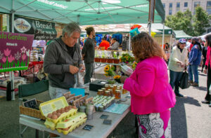
Agriculture can be a tough business. State and local governments support a variety of programs to provide farmers with business assistance and marketing opportunities to support farm viability and strengthen agricultural economies. The Commonwealth has several programs that communities can leverage to create their own strategies, like establishing farmers markets or investing in processing and distribution infrastructure.
Agricultural and Forestry Industry Development Grants
Virginia’s Agricultural and Forestry Industries Development (AFID) fund is a discretionary, performance-based economic development incentive to support agribusiness development. It offers a series of grants to counties and municipalities to develop things like shared-use facilities. Local governments can take advantage of AFID grants to develop and expand businesses, invest in infrastructure to support agriculture, create jobs, and facilitate marketing opportunities, and create plans for agricultural economic development.
Agritourism
Agritourism combines agricultural production with farm entertainment and/or education to diversify farm income and stimulate rural tourism. It can occur on a single farm, or it can be part of a larger economic development strategy.
Community Food and Processing Facilities
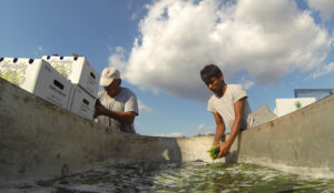 Community food and processing facilities—such as meat processing facilities, community kitchens, and more—protect health and safety while encouraging value-added processing, retail sales, and expanded market opportunities for Virginia-grown food and agriculture products.
Farm to School Programs
Farm to School programs serve a broad purpose: they provide a steady, predictable outlet for farmers to sell their products; they put nutritious, locally grown food in the hands of children; and they help connect more children with food in meaningful ways. Virginia’s program promotes opportunities for schools, distributors, and growers to work together to increase the availability of and access to locally grown foods in school cafeterias and dining halls at all levels of education.
Land Transfer and Access
The next generation of Virginia farmers struggle to gain access to affordable farmland. At the same time, aging farmers who want to see their land remain in agriculture may not have an identified heir or have up-to-date succession or estate plans. A handful of programs—some of which exist in Virginia, and some of which are used in other states—can help support both aspiring and retiring farmers.
Right to Farm
Right to farm laws protect farmers from baseless nuisance complaints and significant and unfair judgments, as long as these farms are following generally accepted or best management practices. Virginia’s Right-to-Farm Act applies to agricultural operations located in areas zoned as an agricultural district or classification who are in “substantial compliance” with laws and regulations and who follow best management practices. It also limits local governments from enacting zoning or other ordinances that unreasonably restrict or regulate farming unless the restrictions bear a relationship to the health, safety, and general welfare of its citizens.
Zoning
Zoning can have a significant impact on farm viability. Zoning ordinances define agricultural uses and determine what kinds of activities are allowed by right or are considered accessory (subordinate to agriculture but related) or ancillary (unrelated). They also determine when uses are conditional and/or require special permitting. Once defined, ordinances usually include performance standards to guide the appearance, intensity, scale, and scope of associated structures. Thus, what communities include in zoning ordinances can make or break a variety of on-farm economic opportunities, depending on local priorities.
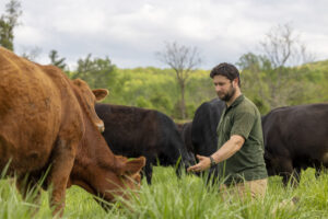
Conservation Agriculture
Virginia’s farmers must manage disruptions from increasingly volatile weather patterns and changing climatic conditions. In any given year, agricultural communities in Virginia can face both severe droughts and severe flooding. Record high temperatures are putting pressure on livestock, creating dangerous working conditions for farmers and farm workers, and reducing crop yields. Intense storms cause major damage from the mountains to the coast.
Conservation agriculture can help farming become more resilient to address this adversity. By embracing practices that enhance resilience and, over the long term, pay off financially, farmers can set themselves up for a better chance at success. While much of the support to advance conservation agriculture stems from federal and state programs, local governments can also support conservation through strategies and efforts like the ones mentioned below.
Chesapeake Bay Preservation
The Chesapeake Bay Watershed covers approximately 60 percent of Virginia’s land area. More than 80 counties, cities, and towns border its tidal waters. Fed by a multitude of rivers and streams that carry pollutants, the Bay has been on EPA’s “dirty waters” list for decades. The health of the Bay is important to millions of people across six states who live in its massive watershed. Farmers can work with their local soil and water conservation district to control nonpoint source pollution.
Composting
Effective composting programs can divert organic materials—like leaves, manures, wood chips, and some food scraps—from landfills and provide a fertile amendment to soils. Composting occurs at many levels, from backyard piles to commercial facilities. Depending on the scale, several different Virginia policies and programs can influence the ways that communities can compost.
Farmer Mentor Programs
Many programs and institutions offer training, advice, and resources for the agricultural community. But sometimes, farmers learn best from other farmers. Virginia has several different farmer mentor programs operating throughout the state that can help farmers adopt conservation practices and improve their bottom lines.
 Connect
Appalachian Sustainable Development Farmer and Rancher Mentoring (FARM) program
Eastern Shore Agricultural Research and Extension Mentoring Network Center
Virginia Farmer Mentor Network
Virginia Forage and Grassland Council Farmer Mentor Program
Virginia Integrated Conservation Agronomy Team
Virginia No-Till Alliance (VANTAGE) Farmer Mentor Program
Local Resource Sheets for Farmers

Farmers can secure support from many different departments, initiatives, and offices. Sometimes, the support available can be difficult to navigate, and farmers may not know where to turn or who to ask for help. Resource sheets that list all the opportunities—and their associated contacts—for farmers in an area can reduce confusion and facilitate more effective engagement.
Soil and Water Conservation Districts
Soil and Water Conservation Districts develop and implement programs to conserve soil and water resources, control erosion, and prevent pollution. District staff help landowners with conservation planning and provide resources to farmers to adopt conservation practices. They promote conservation through outreach and education, providing technical expertise to communities as well as to landowners. In partnership with their local SWCD, localities can allocate additional funding to help support local conservation priorities.
Additional Resources
Census of Agriculture
The U.S. Census of Agriculture, conducted every five years, is a comprehensive collection of statistics about American agriculture. Produced by the National Agricultural Statistics Service, it communicates national-, state-, and local-level findings and is a tremendous resource for local leaders. Below are links to different collections of Census of Agriculture data.
Geospatial Data
American Farmland Trust has an extensive collection of geospatial data to help people understand farmland loss and enhance farmland protection.
Planning for Agriculture in Virginia Presentation Slides
Presenting information about Planning for Agriculture is an important way to build community support and generate buy-in from leaders. You can use the template PowerPoint slides to share useful information for both virtual or in-person presentations. Users may want to modify or add to the slides to meet specific needs and purposes.
Toolkit Resource Collection
This collection compiles all AFT created fact sheets, profiles, checklists, and other resources that are part of the Planning for Agriculture in Virginia toolkit. This book-length resource is ideal for users who prefer all their information in one place and those looking to print all of the resources at once.
Situation Analysis Reports
Virginia Cooperative Extension has conducted a series of “Situation Analysis Reports” across the Commonwealth. Situation analysis reports provide context for understanding and addressing issues, problems, and needs. Local offices update them every 4-5 years.
Supporting Organizations
Many different organizations—from nonprofits and universities to trade groups and government commissions—can help support local governments that would like to plan for agriculture.